Physical Map Of Eudoria

maniac

Alpha
Joined
Jan 27, 2005
Posts
633
Location
Shadows
Society
Church of Lootius
Avatar Name
Konrad D. Knox
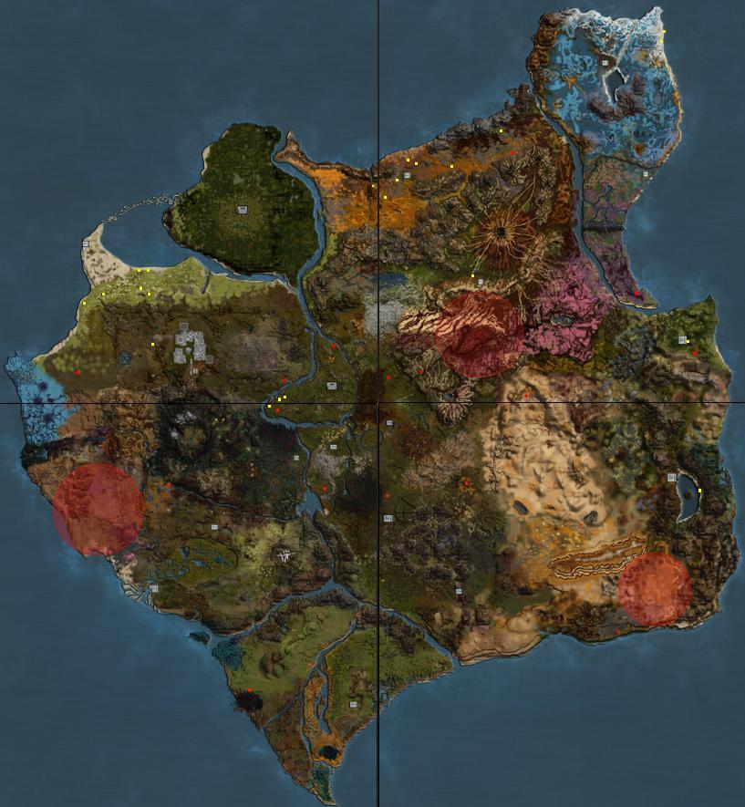
Ok, guys, any forum needs a map, so this one is courtesy of truly yours.

Feel free to copy and use this, modify it, and post statistics which you encountered. You could use this map and mark deposits you found on it over time, mineral migrations, and so on.

I know I know, you wouldn't want to give away mining spots, but old stuff from like VU4 and VU5 would be fun to trace, just as a geological migration study.

EudoriaMap.JPG
 
Cool, but it has to be said that neb's maps are far better, I had the 5.1 version printed out and stuck to my wall for months!
 
Dirk said:
Cool, but it has to be said that neb's maps are far better, I had the 5.1 version printed out and stuck to my wall for months!

Yea his map is damn nice. I even thought of taking it to Kinko's and having a large version of it made :D
 
Faustian said:
Yea his map is damn nice. I even thought of taking it to Kinko's and having a large version of it made :D

I have already done it :laugh:

It actually turned out quite nicely!
 
care to post it here? Please! Dying to see.
 
Wow! Their maps are amazing!
Anyone ever made a geological map? With elevations and stuff?
 
maniac said:
Wow! Their maps are amazing!
Anyone ever made a geological map? With elevations and stuff?


Get to work! :whip:

That'd take alot of time.. I am pretty sure it hasn't been done though.
 
I want a geological map :( but.. as allways.. I dont have time :p and im to lazy
 
Hmmm- you mean a "topographic" map?? Interesting, very interesting....
How do we know the exact elevations of every point though?
 
Svetlana said:
Hmmm- you mean a "topographic" map?? Interesting, very interesting....
How do we know the exact elevations of every point though?

everbody runs round like hell and keeps pressing P,P,P,P,P,P,P :rolleyes:
 
Cindywood said:
everbody runs round like hell and keeps pressing P,P,P,P,P,P,P :rolleyes:


lol- yes but would take A LONG time for one person ;)
I suppose if a team gets together it's possible, not fun, but possible lol
 
We measure it. Rather simple.
I've doen this kinda crap in real life back in the, well, doesnt matter.

If you guys are not really into hunting anymore (like you say you are), and if you have a free time, and if you really wanna build this kind of project, then we can work together as a crew.

PLAN:

Topographic map can be constructed in many ways, but hell, we can only be as precise as humans.

We start looking at physical map first, and identify high points, mountain areas. We start very slowly, peak by peak, and single out more and more peaks, collecting data on one map. You can stand at a peak and look around yourself to get a visual, if the area around this hill is even or not.

If the hill is even, we just average the elevation at the top to the elevation at the bottom, that's the math part.

If the hill is uneven and has odd structure, like Orthos for instant, than we have more problems and go into more extensive measures, like diving off cliffs, pressing P.

This project seems horrible, since Eudoria is huge. But it can really be done if we approach it peace by peace. We start at some easy place, like island Ithaca, we cover that on the map, then as we will get into it, we might want to tackle more of it.

Finally, once data is gathered, we will color code elevations from blue to red (blue being deep sea, white being sea level, green - valleys, yellow - mountains, red - high peaks) with gradual color switches.

The question is: are we curious enough to get this done? Is this cool enough for us to do? Do we want to do it?

How many people would like to participate in this?
 
What would be the advantage of having a topo map?

DD
:evilking:
 
beats me...
 
Someone started on this kind of project about 1½ - 2 years ago, I wonder how far he came...
 
Recoda said:
Someone started on this kind of project about 1½ - 2 years ago, I wonder how far he came...

He's probably still running around in orange jump suit pressing "P" LOL
 
Faustian said:
He's probably still running around in orange jump suit pressing "P" LOL

ROFL :laugh:
With 0 peds.
 
hmmm...

U get me x/y co-ords and elevation details, i can build you a 3D/topo map type and/or 3D virtual space representation :cool:
 
Devil Doll said:
What would be the advantage of having a topo map?
DD
:evilking:
maniac said:
beats me...

Hmmm that's an interesting way of spending time doing something you don't know what to use it for :D
 
What could be more useful is a map with counties, ie. where you must be to t to the desired revive station.
 
Shadow-Ale said:
What could be more useful is a map with counties, ie. where you must be to t to the desired revive station.

ooooo, great idea!

DD
:evilking:
 
Ooooooor! what about a map showing exactly the distances to the nearest deep water and a localised listing of how long it takes each mob to drown and how much water they need to down in! :wise:

Or we could all go out and wing it! :dunce:
 
Shadow-Ale said:
What could be more useful is a map with counties, ie. where you must be to t to the desired revive station.

Of course, that changes with each VU.

Last week, I was running from the revive terminal east of Billy's (between PA & Orthos) to Billy's. I was in sight of Billy's, and got killed - just before the guns fired (they killed the mob that got me). I didn't revive in Billy's, but was back at the terminal I had just left.
 
The terrain is stored in 'Project Entropia\Data\terrain\50.bnt'. Maybe it can be somehow extracted from there? Much quicker than running around pressing 'P'...
 
Shade said:
Of course, that changes with each VU.

Last week, I was running from the revive terminal east of Billy's (between PA & Orthos) to Billy's. I was in sight of Billy's, and got killed - just before the guns fired (they killed the mob that got me). I didn't revive in Billy's, but was back at the terminal I had just left.

that whole area seems prone to reviving you at that outpost instead of at billy's. pretty annoying.
 
Recoda said:
Someone started on this kind of project about 1½ - 2 years ago, I wonder how far he came...
Recoda is right but the project got nowhere. I've heard people talk about it a couple of times since but never seen anything happen. It's a MASSIVE project.

If someone takes this on, I suggest you start with just one are to see how it goes.

Most importantly, I suggest someone eles do it besides me :)
 
I have never used maps made by people, whats so special about it? Ingame map works fine, I certainly dont need a map with topographic features since I fail to see how that would improve the gaming experience :tongue2:
 
Well, it's not really for improvement.
It's more of a curiousity-creativity-hobby kinda thing.

Would be a fun project to do if got nothing to spend time with.
 
Back
Top